China’s Geography: The Physical Story
Introduction

With a total area of nearly 9,600,000 square kilometers, China’s landmass is slightly smaller than that of Europe. It stretches about 5,000 km from east to west, and about 5,500 km from north to south. China has land borders with 14 nations including Afghanistan, Bhutan, Myanmar, India, Kazakhstan, Kyrgyzstan, Laos, Mongolia, Nepal, North Korea, Pakistan, Russia, Tajikistan, and Vietnam.
Mountains, hills, and highlands cover about 66 percent of the nation’s territory. China’s surface slopes down in steps, starting from the Tibet plateau at 4000 m. China’s second geographical step averages 1-2000m and includes the Mongolia, Loess, and the Yunnan-Guizhou plateaus, and the Tarim, Junggar and Sichuan Basins. The third step, with an average elevation of 500- 1000 m, begins roughly at the edge of the Greater Hinggan, Taihang, Wushan and Xuefeng mountain ranges, and continues east to the coast.
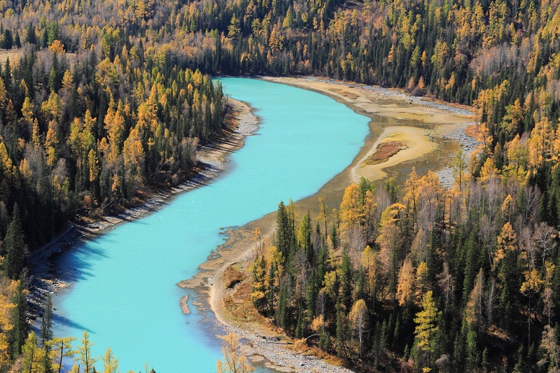
Descending these geographical steps, China’s major river systems wind their way from west to east. Its largest river systems include the Yellow River in the north, the Yangtze River in central China, and the Pearl River in the south, all of which flow from the higher plateaus to the eastern Oceans. Along China’s east runs a 14,500 km coast.
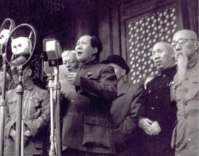
Much as any other nation, the development and the history of the Chinese civilization have been profoundly influenced by its geographical setting. As early as 400,000 BCE, cave dwellers lived in China. Beginning in approximately 8000 BCE, people in north and central China began domesticating animals and growing food, especially millet in the Yellow River valley of the north and rice in the Yangtze River valley to the south. A warming climate aided agricultural innovation. The surplus food production allowed more populous and complex societies to evolve. By 5000 to 4000 BCE Neolithic settlements were scattered throughout China. By 2000 BCE these village settlements saw people begin to specialize in different kinds of productive occupations. By 2200 BCE, China’s first dynasty was formed. By 1500 BCE, the Han Chinese had developed a sophisticated civilization with character writing, bronze technology, the world’s most productive agriculture, walled cities and towns, and a powerful, national army.
Once China was established, it mountains, deserts, empty steppe lands and uninviting coast provided natural barriers that helped China to maintain remarkable continuity in language, cultural values, and social and political institutions, making China the world’s longest continuing civilization. China has historically been an inward looking country, content to develop within the confines of its vast continent. That said, it has also been shaped by a continual stream of outside influences, such as the arrival of Buddhism from India, the periodic invasion by Mongols from the north, and the trade of goods, most famously along the commerce networks of the renowned Silk Road.
China’s Western Lands

The western land of China is characterized by high plateaus and multiple mountain ranges which are broken by vast basins and deserts. This land is arid and cold, and suffers from constant drought. The lack of water has limited the number of people living in the region. Only 6% of China’s total population lives in the western half of the country.
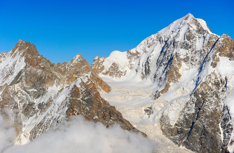
Most of China’s mountains, including its five main mountain ranges, trend west-east. In southwestern China, the Himalayas and the Kunlun Mountains enclose the Tibet Plateau, which encompasses most of Tibet Autonomous Region. The Tibet Plateau with an area of 2.5 million kilometers, is China’s highest and largest plateau, about four times the size of France. Mount Everest is part of the Himalayan range and is located on the China-Nepal border. The Gangdise range parallels the Himalayas to its north. The Tien range crosses between the massive Tarim Basin to the south and the Junggar Basin to the north. Rich deposits of coal, oil, and metallic ores lie in the Tien Shan area. Between these two basins lies Turpan Pendi, which at 154 m below sea level, is the lowest point in China and the second lowest place in the world after the Dead Sea.
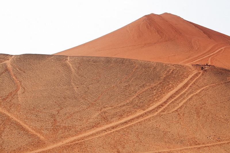
To the north of the Tibetan Plateau lies the Gobi and Taklamakan deserts, which stretch from the extreme northwest eastwards through Mongolia. The Gobi is the largest desert in Asia, covering parts of northern and northwestern China and Mongolia. The Gobi was part of the Mongol Empire and was traversed in part by the ancient Silk Roads. It is a cold desert for much of the year, and it is not uncommon to see frost on its dunes. Northeast of the Gobi, the Heilongjiang or Black Dragon River flows for 3,101 kilometers.
South of the Gobi lies the Inner Mongolian Plateau, an average of 1,000 m above sea level. The Yin mountain range, averaging elevations of 1,400 m, extends east-west through the plateau’s center. To its south is the largest loess plateau in the world, covering 600,000 km. Loess is a yellowish soil originating from the Inner Mongolian deserts. The soil is carried easily on the wind, and through the centuries, it has choked the Yellow River with silt. The Loess sand also plagues Beijing and its surrounding areas with dust storms, which turn the sky yellowish-gray and force people indoors or into protective gear. A March 2011 sandstorm, for instance, affected about 250 million people over an 808,000 sq. km area. China is planting thousands of acres of vegetation to stop spreading desertification, but the work will take decades to finish.
Along an arc that roughly outlines the southern edge of Inner Mongolia, the Great Wall of China extends approximately 8850 km, including 6260 km of actual wall, as well as trenches and natural defensive barriers such as hills and rivers. The wall was built to protect the northern borders of the Chinese empire against invasions by various nomadic tribes.
Eastern China
The eastern part of China is divided north-south by the Qinling Mountains, an extension of the Kunlun Mountains. This boundary is both physiographic and cultural. To its north flows the Yellow River, travelling through the North China Plain to the Yellow Sea. Home of Beijing, the Yellow River basin is called the “Cradle of Chinese Civilization.” It was the most prosperous region of early China, and has been the center of Chinese expansion and influence since ancient times. The North China Plain is vulnerable both to flooding and earthquakes. Over the last 3000-4000 years, the Yellow River has flooded over 1500 times often with catastrophic effect. For example in 1931, the flooding of the Yellow River, in combination with the Yangtze and Huai rivers, is estimated to have caused between 1 and 4 million deaths.
South of the Qinling mountain range are the heavily populated and exceedingly developed lower and middle plains of the Yangtze River and, on its western reaches, the Sichuan Basin. Crossing 6,300 km through the heart of the country, the Yangtze is China’s longest and most important waterway. It is navigable over much of its length, and has a vast hydroelectric potential. The Three Gorges Dam, for instance, spans the Yangtze at the town of Sandouping in Hubei province. Connecting the Yellow and Yangtze Rivers is the 1776 km long Grand Canal, one of the greatest engineering projects in China, and the longest artificial river in the world. Constructed between the 5th century BC and the 7th century AD, it is the only major Chinese waterway running from north to south.
Second only to the Qinling range as an internal boundary is the Nanling mountains, the southernmost of the east-west mountain ranges. South of the Nanling mountains is the Pearl River and its many tributaries which all flow into the Pearl River Delta. The Pearl River – used as a catchment term to refer to the watersheds of the Xi, Bei, and Dong (West, North and East) Rivers – is China’s third longest river after the Yangtze and Yellow Rivers and second largest by volume after the Yangtze. The Pearl River takes its name from all the Pearl colored shells which lie at the bottom of the river in the section which flows through the city of Guangzhou.
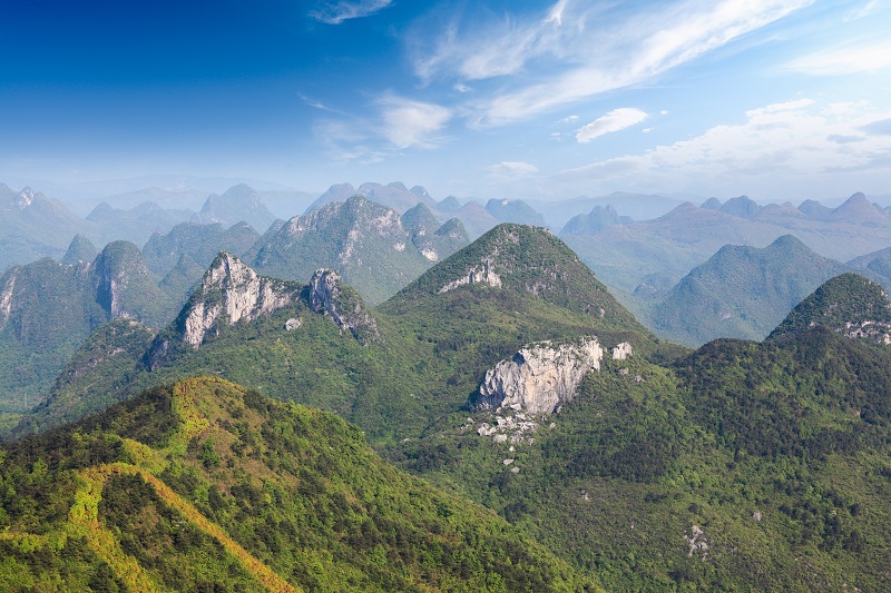
West of the mountains of the Pearl River, the Yunnan-Guizhou Plateau rises in two steps toward the mountain regions of the eastern Tibet Plateau. In Yunnan province, the plateau averages 2000m is characterized mountain peaks as high as 3700 m. In the Guizhou range, the plateau averages 1200 m in height, and is characterized by rolling hills, deep river-carved gorges and mountains marked with geological faults. Karsts – distinctive geological features caused by water eroding the limestone underlying the plateau- dominate the landscape. Such karst features include sinkholes, caves and natural bridges, and large underwater aquifers. The Yunnan-Guizhou plateau is the source of the Yangtze and Yellow Rivers.
In spite of the 14,500 km coastline fringed with offshore islands, China has traditionally oriented itself not toward the sea but inland, developing as an imperial power whose center lay in the middle and lower reaches of the Yellow River on the northern plains. The southern part of the coast is rugged and mountainous so that its good harbors provide poor access to the inland regions. The north coast is low and swampy. The Yellow, East China, and South China Seas are all part of the larger Pacific Ocean.
Arable Land
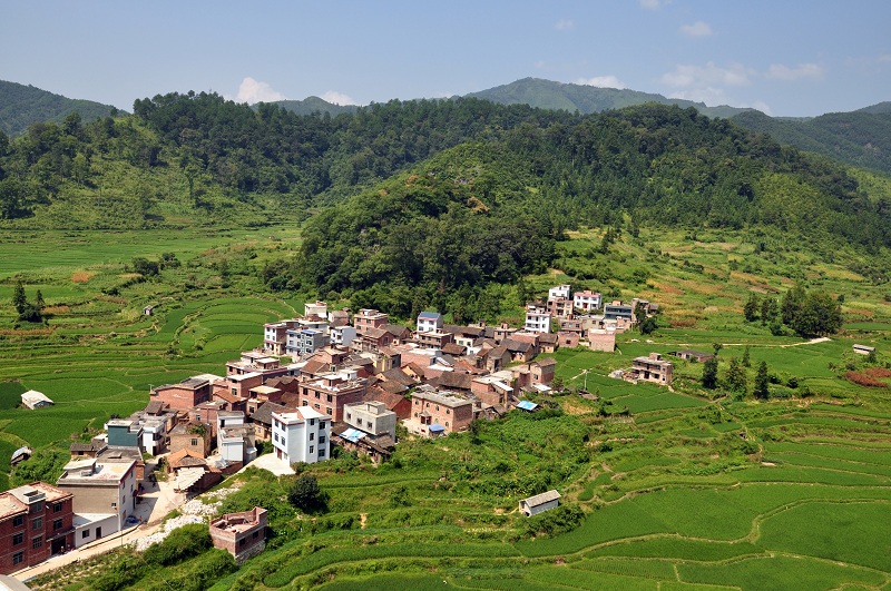
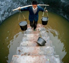
Because of the mountainous and arid nature of its geography, only about 15% of China’s total land area is suitable for farming, almost all of which is under plow. The lack of and the nature of its arable land has also led to one of the most labor-intensive agricultural systems in the world. Farming in the arid north along the Yellow River has required much coordinated effort, both to create irrigation systems and to build dykes to prevent the Yellow River from constantly flooding. Similarly, in the south, rice cultivation has always been extremely labor-demanding. From creating the clay-bottomed rice plots that trap water, to laying the muddy ground into which the pre-grown rice shoots are planted, to the intricate fertilization and pest removal that each shoot requires, to the rapid harvest of the ripe rice and quick re-planting to ensure two and sometimes three crops per year, wet rice production in the south is one of the most labor intensive crops in the world. Rice cultivation is also one of the most efficient in the numbers of people it can sustain. In fact, for much of its history, China has been one of the most populous countries of the world.
It has been argued that the demands of China’s irrigation, water and agricultural management have caused the Chinese to be a collective minded rather than individualistic people. What is true is that the Chinese have historically shown a great ability to organize its people to undertake tasks on a large scale such as the building of roads, dams, canals and defensive walls as well as the large scale production of iron and porcelain. It has also been argued that the nature of rice agriculture has caused China to develop a tradition and culture of hard work which is manifest in China’s work ethic today. What is indeed true is that the Chinese rice farmer works significantly more hours per year than a farmer sowing other crops such as wheat and corn.
China’s most important food crops are rice and wheat. Due to its high water and warmth requirements, most of China’s rice crops are planted in the south. This region also produces tea, sugarcane, and the mulberry leaves which feed the silkworms. Wheat is the chief crop of the north. Other northern crops include millet, maize, kaoliang (sorghum) and soya beans. In a few areas, cotton and peanuts are grown. Cattle, sheep, and horse ranching are limited to the grasslands of Inner Mongolia, Xinjiang, and Tibet. Ranching is rare in China proper because there are not the wide open plains necessary to maintain large herds. The optimal use of land is for cultivation of crops and animal husbandry, and most farmers keep chickens, ducks and pigs. This land constraint explains why there is a large-co-habitation between foul, swine and people in China, and why it has proved to be an effective breeding ground for such viruses as SARS and Swine flu.
China is currently losing arable land due to desertification and rapid urbanization. Currently, approximately 400 million people live in towns and cities, and China now has over 160 cities with populations greater than 1 million people, the largest being Shanghai and Beijing. By 2050, China expects 1.1 billion of its citizens to be in urban settings.
Climate
China’s climate is as varied as its topography. China’s climates range from the cold-temperate north to the tropical south, with subarctic-like temperatures in the Himalayan Mountains. In the winter, there is little rain or snow anywhere in China. In the summer, the warming land draws tropical sea air saturated with moisture into southern China. As the air encounters mountains and cooler inland air masses, rains fall plentifully in southern China. As the summer monsoon moves northwest, it brings less rain, meaning that overall China’s north is dry and its south is verdant. In bad years, the monsoons are too weak to cross into the Yellow River Valley, and become stuck over the central mountain belts, causing drought in the north and flooding in the south. In 2011, for instance, large floods in Southern China killed 132 people and displaced 800,000.
Nevertheless, overall, China is an arid country and is facing an increasingly severe water crisis. In 1997, for instance, the downstream stretches of the Yellow River ran dry for 226 days. In a project reminiscent of the Grand Canal, China has plans to build a vast new aqueduct – the South-North Water Diversion Project – which will divert at least six trillion gallons of water each year from the Yangtze River to satisfy the water needs of the North China Plain. The project has been likened to diverting water from the Mississippi River in the United States to meet the water requirements of Boston, Washington and New York and is projected to cost $62 billion, twice the cost of the Three Gorges Dam, the world’s largest hydroelectric project.
People
Around 1.3 billion people, or approximately a fifth of the world’s population, live in China. The Han Chinese, the native Chinese-speaking people, comprise approximately 90% of the population. 55 different ethnic groups, including the Uighurs, Mongols, and Tibetans account for the remaining 10%. China has seven large language groups each of which contain hundreds of dialects. Mandarin, based on the Beijing dialect, is China’s common language, and can be spoken by most Chinese people who have completed primary education.
Although the Communist regime has discouraged the practice of religion, temples and pagodas are found in most Chinese cities. For millennia, Chinese life has been influenced by the teachings of Confucianism, China’s major belief system. Buddhism and Taoism are also significant religions in China, and Islam is practiced by many of China’s ethnic minorities.
China’s Geography Today
The geography of China today has been altered over thousands of years by human habitation. The cleverness that enabled the Chinese to to support a population that exceeded 100 million people as early as the 12th century has extracted a real ecological toll on the country. One of the great tests facing China today is whether it can protect its natural resources during its current rapid development.
At the heart of this challenge is China’s scarcity of water. With 20% of the world’s population, but only 7% of global water resources, China faces severe water challenges. Mainland China has a per capita share of water of 2700 m³ per day, or one quarter of the world’s average. Moreover, the area south of the Yangtze River, which accounts for only 37% of China’s physical land, has 81% of China’s total water supply, while the 63% of land north of the Yangtze has only 19% of China’s water. Northern water demand is depleting underground aquifers. Drilling deeper to gain new water access has caused naturally occurring arsenic pockets to be reached, increasing the presence of arsenic in some water supplies. The World Bank predicts that by as early 2020, there may well be as many as 30 million environmental refugees within China due to lack of water and desertification.
The fresh water that China does have is often heavily polluted. 90% of the city’s groundwater and 75% of rivers and lakes are contaminated, and it is estimated that 700 million people drink polluted water daily. Water pollution occurs from industrial and municipal emissions, pesticides and fertilizers, and acid rain. Additionally, industrial pollution incidents, such as Songhua River toxic chemical spill in November 2005, have become more common.
The diversion to China of more of the water resources of major trans boundary rivers such as the Brahmaputra River and the Mekong River, risks being an increasing source of tension between China and countries such as Vietnam, Laos, Cambodia, Thailand, India and Bangladesh. For instance, China has built two dams on the Mekong, and has plans to build three more, inciting anger in Vietnam, Laos, Cambodia and Thailand. In the book Tibet’s Waters Will Save China, Chinese ex-officials have looked at ways for China to keep more of the Brahmaputra River to meet China’s growing water needs.
Another water related issue is China’s rapid building of dams to capture its hydro-electrical potential. Projects such as the Three Gorges Dam have not only raised environmental concerns as ecosystems are disrupted, but they have caused increased social unrest as millions of people are uprooted, sometimes without fair compensation. Environmental and social concerns around dam building will remain key points of debate in China in the near future.
There is a high correlation between the fertility and resources of its various areas and the wealth of its populace. Most of the wealthiest Chinese live in China’s southeast, where water is abundant, where as many as two to three rice crops can be harvested each year, and where easy access to export markets caused the region to lead China’s re-integration into the global economy. Similarly, the east coast of China is wealthier than its hinterland as it has better access to global trade. The poorest Chinese live in the arid north-west where deserts, mountains, and high-elevation plateaus prevail. Increasing inequality, caused in no small part by China’s geographical diversity, is an important concern for Communist party leaders. Growing social discontent at the increasing difference of wealth between regions and between people is a real risk to the Communist Party’s control of power.
Tectonically, China remains one of the most active seismic regions of the world. The country has a long history of being hit by deadly earthquakes. The largest earthquake occurred in 1556, where it was estimated that over 800,000 people died. Since 2005, China has experienced four deadly earthquakes in 2011, 2010, 2008 and 2005. According to official figures, the 2008 Sichuan earthquake killed over 69,000 people, and left almost 5 million people homeless. These earthquakes will continue to generate debate not only about Chinese construction standards and Chinese compliance with building codes, but also about the quality of China’s public health care system. Many of the 2008 Sichuan victims, for instance, had little or no health insurance, and poor access to healthcare facilities.
Flooding will also remain an issue for China. The summer monsoon draws tropical sea air saturated with moisture into southern China. In bad years, the summer monsoons become stuck over China’s central mountain belts and fail to reach the Yellow River Valley, causing drought in the north and flooding in the south. In 2011 it was estimated that floods caused $1.2 billion in losses, disrupted the lives of approximately 5.7 million people and damaged or destroyed more than 7000 homes. Areas most vulnerable to flooding include Zhejiang, Sichuan, Chongqing, Hubei, Anhui, Jiangxi, Hunan and Guizhou.